Garfield Heights: A Brief Historical Overview
Gaze north anywhere in Pasadena, and the most striking view you will see is the San Gabriel mountains. Perhaps it was this panoramic view that caused early adventurers to settle here. These early settlers experienced a different Pasadena than we know today, but even they were newcomers, for in fact the threads of this story go back centuries.
Tongva, Gabrieleño and Kizh: these are among the names that describe the Indigenous peoples who once called these lands home. Living for centuries in as many as 100 villages over 4,000 square miles, their landscape included the local villages of Hahamongna, Povomeparngna, and Puntitavjatngna. Along with the neighboring Chumash, the Tongva were the most influential native peoples at the time of European arrival in 1542. Following the establishment of Mission San Gabriel Arcangel in 1771, the Tongva were subjected to religious conversion, forced labor, repression, and the expropriation of sacred tribal lands first by Spanish missionaries, and then later by rancheros with land grants. The missionaries called the Tongva people Gabrieleños.
When the Mexican government took control of the mission lands in 1834, it granted parcels to loyal soldiers and farmers, leaving the Indigenous peoples homeless. Many found work on ranches throughout the San Gabriel Valley. Others refused to succumb, forming smaller settlements to live away from the invaders. The last known local tribe is believed to have lived at Indian Flat (now Linda Vista), a short distance west of Garfield Heights, as recently as 1884. Despite these threats the Tongva, Gabrieliño and Kizh persevered, and their descendants today take pride in the expression of their cultural identities.
The era of the Californios drew to a close as a cycle of floods, droughts, title battles and American occupation devastated the Californio economy; the fertile Mediterranean landscape now changed once again. With the founding of the Indiana Colony company in 1874, settlers seeking the area’s temperate, pleasant climate came to found the community that we now know as Pasadena.
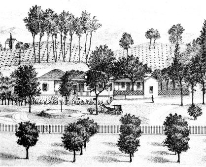
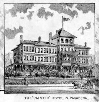
Between 1879 and 1881 two Iowa farmers, John H. Painter and Benjamin F. Ball were among those came to Pasadena. Ball and Painter were originally from Ohio, migrating to Iowa in the 1860’s before relocating to Pasadena. They had initially sought to purchase approximately 500 acres in North Pasadena.
The land they were interested in belonged to a Henry Monk of New York. The property sat idle after Mr. Monk was informed by a well-meaning friend that it was of little use. Seeing little reason to hold onto it, he decided to rid himself of the entire 2000 acres. Rather than let the land fall into the hands of the growing competition, Painter and Ball purchased all 2000 acres in 1881 for $30,000.00. From that point on the tract became known as the Painter/Ball tract.
Garfield Heights is a small fragment of that original acreage, which was bound by Woodbury Road, Arroyo Drive, Lake Avenue and Villa Street. Located in Northwest Pasadena, the area was known as Block R.
In 1886, the little “Indiana Colony” incorporated as the City of Pasadena. By 1893 some of the known streets in Garfield Heights had already been established: Marengo Avenue, Washington Street, Claremont Street, Douglas Street, Los Robles Avenue, Van Wyck, and Adena Street. In 1904, the area known as “Block R” was named Garfield Heights and annexed by the city of Pasadena. Many of our homes were built during the boom years between the late 1880’s and the 1920’s. While some were built by notable builders and architects, the vast majority were not. Nonetheless, each reflects a sense of charm and grace that is difficult to find in a modern home.
Today, with the protections afforded by the neighborhood’s designation as a Landmark District in 1998 and the adoption of its conservation plan in 1999, most of those old homes remain intact. They stand as a reminder of the heritage left to us by folks like Henry Monk, John Hunt Painter, Benjamin Ball, abolitionist Owen Brown, and the Indigenous peoples who first recognized the beauty and bounty of this landscape.
~This historical vignette was originally created by Renee Pierson, and has been edited to include additional information by Steve Preston.
How did Garfield Heights get its name?
While there is no conclusive evidence as to the origin of the name of our neighborhood, research in conjunction with the Pasadena Museum of History and the Pasadena Public Library has gleaned several interesting tidbits.
|
Maps show that southern parts of Garfield Avenue today used to be Adella and Worcester, at least till 1898. Dr. Hiram Reid gives a history of street names in his book “History of Pasadena.” Adella Street was named by Mr. A. Ninde in 1886 who named it after his daughter; the same year Worcester Avenue was opened by E. L. Farris who named after his wife's birthplace in Massachusetts. No documentation was found as to why the names were changed to Garfield Avenue.
The street name of Garfield existed prior to 1904, before the subdivision was created. According to Sanborn Insurance maps, it was named sometime between 1894 and 1903. Garfield Avenue is a boundary for the tract, so it is likely the existing street name was the impetus for naming of the neighborhood. U.S. President James A. Garfield was assassinated in 1881; and the educated guess is that the street was named for the late President. There used to be a school at California and Pasadena Avenue (now Orangewood Plaza Shopping Center) which started as California Street School in 1888 and was renamed James A. Garfield Elementary School in 1890. In 1904, Garfield’s widow, Lucretia, bought a house in South Pasadena (designed by Greene and Greene). That same year the Block R tract was named Garfield Heights and annexed to the City of Pasadena. The supposition is that Lucretia’s arrival in the area may have precipitated a bit of “Garfield revival;” and Garfield Heights (which already had Garfield Avenue running through it) may have been named in the former President’s honor. No proof, but a guess based on what was going on at the time. |
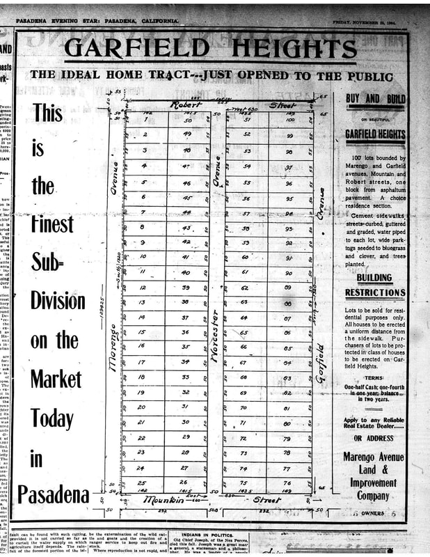
The Pasadena Public Library was able to provide us with two historic images from the Pasadena Evening Star, which gave us a glimpse into the founding of our neighborhood. The first article, dated November 25, 1904, (above) actually shows a map of the first 100 lots offered for sale in the new neighborhood, which was bounded by Mountain Avenue, Marengo Avenue, Garfield Avenue and Roberts Street (which is now Hammond Street).
Pasadena Evening Star – November 25, 1904. Image courtesy of Pasadena Public Library. Click to enlarge. |
|
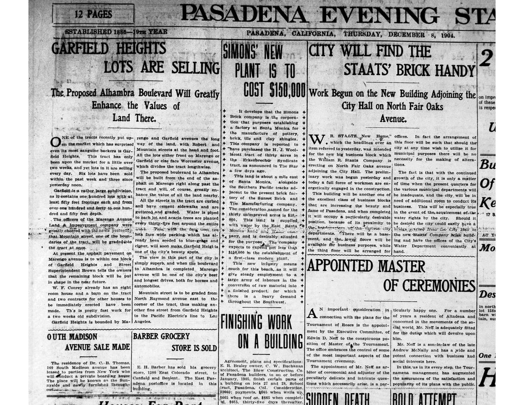
The second article, dated December 8, 1904, exclaims how quickly lots have been selling in the new subdivision and talks about the infrastructure improvements being made.
While we may never know the story behind the naming of Garfield Heights, we are thrilled to have these images that give us a window into the history of our neighborhood. Many thanks to Anuja Navare, Archivist at the Pasadena Museum of History; and Nick Smith and Dan McLaughlin, Research Librarians at the Pasadena Public Library, for helping us to gain insight into our local history. Pasadena Evening Star – December 8, 1904 Image courtesy of Pasadena Public Library. Click on it to enlarge/download. |


