Garfield Heights Landmark District
In 1999, the irregularly shaped, shaded area on the map below was designated by the City of Pasadena as the Garfield Heights Landmark District. It became the City's second landmark district after Bungalow Heaven. Pasadena currently has 23 landmark districts and 20 historic districts. CLICK HERE for more information and a map of Pasadena's landmark districts.
Garfield Heights Neighborhood Association boundaries extend beyond the Landmark District boundaries. GHNA is bounded by the south side of Washington Boulevard on the north, the north side of Mountain Street on the south, the west side of Marengo Avenue on the west, and the west side of Los Robles Avenue on the east. The areas of the Neighborhood Association that are not included in the Landmark District did not accumulate the necessary 51% of residential votes needed to become a protected landmark district.
Garfield Heights Neighborhood Association boundaries extend beyond the Landmark District boundaries. GHNA is bounded by the south side of Washington Boulevard on the north, the north side of Mountain Street on the south, the west side of Marengo Avenue on the west, and the west side of Los Robles Avenue on the east. The areas of the Neighborhood Association that are not included in the Landmark District did not accumulate the necessary 51% of residential votes needed to become a protected landmark district.
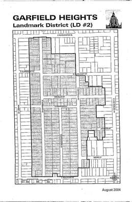
Click to enlarge map.
|
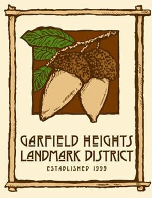
The first Garfield Heights Landmark District logo was designed by Michael O'Brien and featured two Coast Live Oak acorns.
|